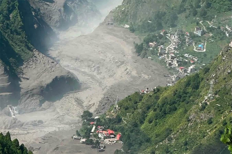

On August 26, 2026, under a clear sky with not a drop of rain, a wall of ice and rock broke off a mountain near Langtang. Within minutes, the border crossing, the bridge, and miles of road were gone.
Here's what actually happened, and what it means if you're planning to travel through this region.
The Artery Severed
Before August 26, most travelers had never heard of Rasuwagadhi.
But for trade and tourism between Nepal and China, it was everything.
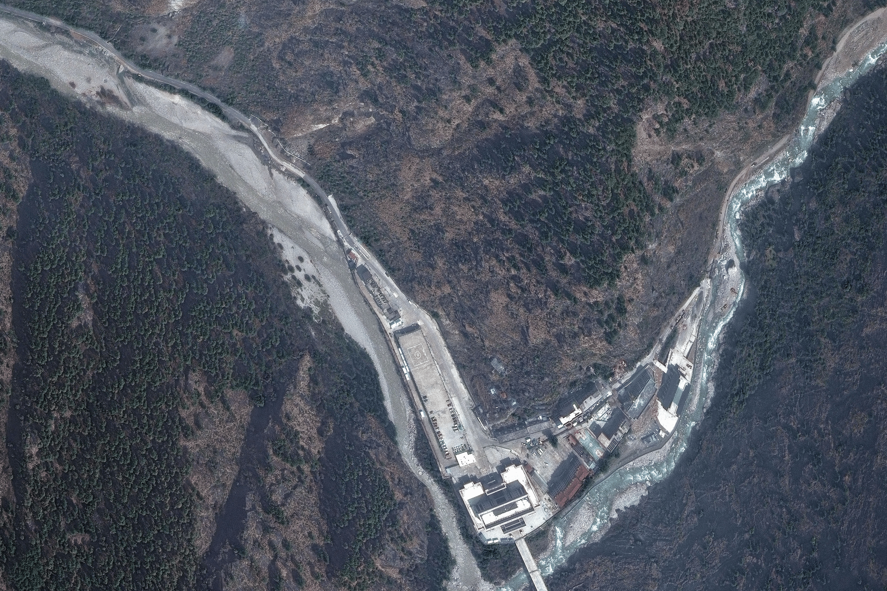
Rasuwagadhi (known as Gyirong Port on the Chinese side) was Nepal's main overland gateway to Tibet. Trucks carrying Chinese goods crossed here daily. Pilgrims heading to Mount Kailash passed through here. Trekkers on the Tamang Heritage and Langtang routes used this corridor to reach their trailheads.
This crossing had already been tested. A smaller flood in July 2025 swept away the original Friendship Bridge. Engineers rebuilt it with a temporary Bailey bridge, and trade slowly recovered.
That temporary bridge is now gone too. So is the customs yard at Timure. So is a large part of the town itself.
The "Clear-Sky" Reality
Most floods in Nepal happen during monsoon season, after days of heavy rain.
This one didn't.
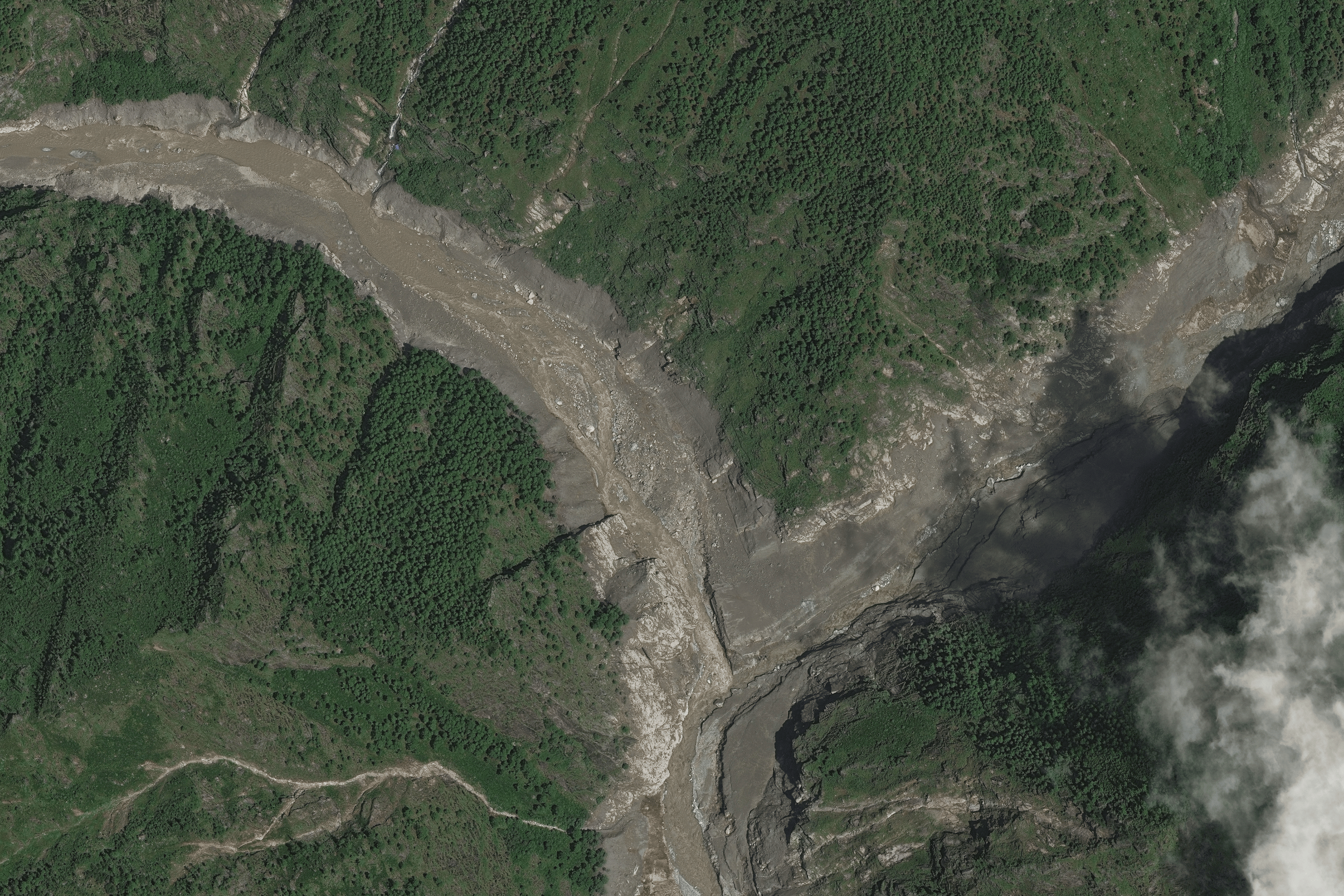
On the morning of August 26, an estimated 600-meter-wide mass of ice and bedrock broke loose near the Langtang Lirung massif. No storm triggered it. Scientists point to thermal stress: warming temperatures weakening the ice and rock that once held the slope together.
The debris crashed into a tributary called the Lhende Khola, about 20 kilometers upstream from the border. It formed a natural dam.
That dam held for only a few minutes. When it gave way, a wall of water, mud, and boulders surged downstream. Within minutes, it reached the border. Within an hour, it had traveled dozens of kilometers into Nepal.
This is worth repeating: it did not rain. This was a glacial and geological event, not a weather event. It's a preview of a new kind of Himalayan hazard, one driven by a warming climate rather than a storm system.
The Road Downstream
The flood didn't stop at the border. It followed the Bhote Koshi River into the Trishuli River system, carrying destruction with it.
The Department of Roads confirmed that roughly 42 kilometers of highway between Betrawati and Rasuwagadhi were damaged or destroyed, along with another stretch between Syabrubesi and the border. Bridges along this corridor were washed away entirely.
Syabrubesi, the main gateway town for Langtang trekkers, took heavy damage. So did smaller settlements along the way, including Timure, Mailung, and parts of Betrawati.
The energy sector was hit hard too. Nepal's electricity authority confirmed damage to 13 hydropower projects, including the Rasuwagadhi plant, Chilime, and Trishuli 3A. Roughly 431 megawatts came off the national grid, more than a tenth of what the flood-affected region normally generates.
The human cost is still being counted. As of September 9, Nepal's police put the confirmed death toll at 1,365, with another 43 confirmed dead across the border in Tibet. Around 4,600 people remain missing on both sides. Among them are hydropower workers, security personnel, trekking guides, and foreign nationals, including pilgrims bound for Kailash. These numbers are still rising as search teams reach remote areas, so treat any figure, including this one, as a snapshot rather than a final count.
Prime Minister's Disaster Relief Fund (official portal): https://pmdrf.nchl.com.np/
What This Means for Travelers
If you had a trip planned through this region, here's where things stand.
The overland Nepal-to-Tibet route is closed, with no reopening date. The road and the bridge both need to be rebuilt, not just cleared. Officials have not given a timeline. Some tour operators are warning clients not to assume the route will reopen even by November.
The 2026 overland Kailash Mansarovar season is effectively over. If you booked this pilgrimage through Rasuwagadhi this year, plan on flying Kathmandu to Lhasa instead. The alternate Kodari crossing isn't a workaround for most itineraries either, as it doesn't serve the same route.
Langtang, Gosaikunda, and Tamang Heritage treks are currently suspended for tourists. This isn't because the trails themselves are damaged. The upper Langtang Valley sits on a different river system than the one that flooded, and the trail toward Kyanjin Gompa hasn't been physically harmed. The problem is access: the road to the trailhead at Syabrubesi runs straight through the damaged corridor.
Most of Nepal's other trekking regions are running normally. Everest, Annapurna, Manaslu, Mustang, and Kanchenjunga sit on entirely different river systems and were not affected by this event. If your autumn plans included one of these, they should proceed as usual, though it's always worth a final check with your operator before departure.
If you already had a Langtang-area trip booked, don't cancel outright. Talk to your operator about whether an October or November start still makes sense, or whether an alternative route like Helambu or Ama Yangri might suit your dates better.
Frequently Asked Questions
Is the overland border between Nepal and Tibet open? No. The Rasuwagadhi–Gyirong crossing has been closed since August 26, 2026, and there is no confirmed reopening date. Both the road and the border bridge need to be rebuilt.
Did monsoon rain cause the 2026 flood? No. The flood happened under clear skies with no rainfall. It was triggered by an ice-and-rock collapse near the Langtang Lirung massif, which dammed a river and then burst.
Is the Langtang trek safe? The trail itself, from Syabrubesi up to Kyanjin Gompa, sits on a different river system and wasn't physically damaged. However, treks into the Langtang region, including Gosaikunda and Tamang Heritage, are currently suspended for tourists because the access road was destroyed. Other major trekking regions in Nepal are unaffected and open as usual.
Stay Ahead of the Situation
Conditions in Rasuwa are changing week by week. Road repairs, border updates, and trekking permissions are all in motion.
If you're planning a trip to Nepal or an overland journey to Tibet, don't rely on a single blog post, even this one, for your final decision.
Get the free Valley & Peaks Nepal Travel Guide. We update it as conditions on the ground change, so you're planning around today's reality, not last month's.